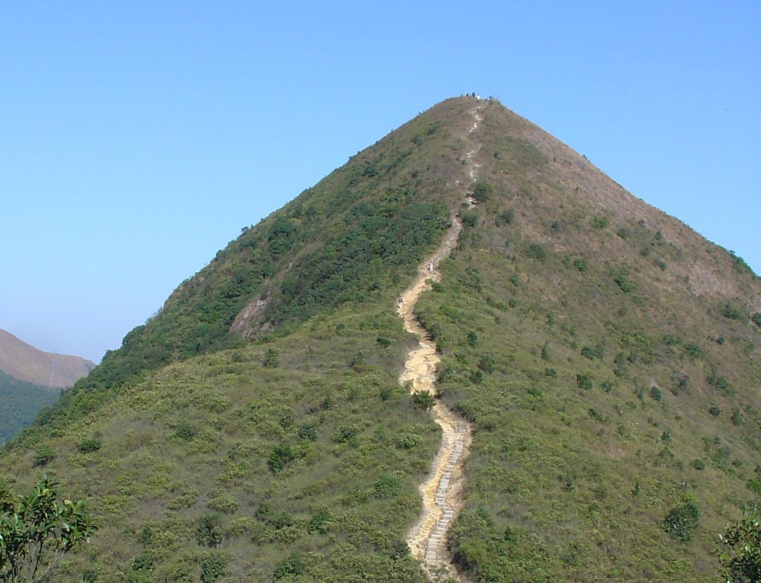
Trail file
Difficulty 4/5 · Shing Mun Country Park
Needle Hill
Shing Mun’s spike. Straight up and down on steps — short, steep, reservoir geometry.
7 km · 532 m ↗ · 3.5–5 h · Tsuen Wan
LUFC · CC BY-SA 3.0 · Wikimedia Commons
Distance
7 km
Elevation
532 m
Moving time
2.5–4 h
Clock time
3.5–5 h
Elevation profile
200–532 m
Trail map
22.390000, 114.146000
Location unused. Tap “My location” to measure distance with browser GPS.
Reconstructed schematic path (not a surveyed GPX)
How to go
- Outbound
- Tsuen Wan then minibus 82 to Shing Mun, or Lei Muk Shue approach.
- Return
- Reverse to Tsuen Wan, or continue the Shing Mun forest loop.
- Last transport
- Minibuses end before the MTR.
- Abort / bad weather
- Abort if stairs are slick.
- From the hubs
- Central 45–60 min to Tsuen Wan.
- Octopus / transfers
- MTR + minibus Octopus.
All regions
- Start district
- Tsuen Wan
- End district
- Tsuen Wan
- Country park
- Shing Mun Country Park
- Long-distance trail
- Links toward MacLehose Shing Mun stages
- Villages
- Shing Mun
- Approx. grid
- 22.39°N 114.15°E
- Management / emergency
- AFCD Shing Mun.
Analysis
Exposure
3/5
Scrambling
2/5
Shade
Forest; exposed summit
Signal
On the summit
Reservoir is not drinking water
Not family-friendly
Crux
Stair lungs.
Analysis
Short, steep, reservoir foreground.
- Start
- Shing Mun Reservoir
- End
- Shing Mun
- Scenery
- Shing Mun reservoir, the needle
- Fitness
- Stairs.
- Season window
- Autumn–winter. Summer: early.
- Risk
- Slick steps, heatstroke.
- Kids
- Not recommended.
- Older walkers
- Not recommended.
Gear
- · 2 L, gloves
Water
- · Tsuen Wan. Shing Mun visitor centre if open.
Toilets
- · Shing Mun BBQ / visitor centre.
Resupply
- · Tsuen Wan.
Risk
- · Straight up-down stairs
- · Weekend bike-path conflicts