Gallery
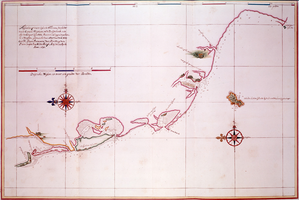
This detailed navigation chart shows the coastline of Taiwan from the Bay of Tayouan southward (left is north). It is one of the best surviving maps of Taiwan's coast. Used by permission of the Austrian National Library (finding aid: Atlas
Johannes Vingboons · Public domain · Wikimedia Commons
Product-boundary pin: Kenting is a separate south-Taiwan trip — not this map's core.
Best time
Weekday morning or dusk; weekend noon crowds tighten.
How to go
MRT / LRT / station: n/a. Read the signs after exit.
Tips
- · One axis a day — do not jam another district.
- · Last trains and closures follow that day’s notice.
Next stop
Where this line goes next
Walk, LRT or one MRT stop to the next place. Another district is another day.
Foguangshan pagoda distant view
Kaohsiung MRT · 35min
Kenting outside this station → Foguangshan pagoda distant view: same-district MRT/LRT (~35 min)
Next is Foguangshan pagoda distant view on the kaohsiung-day axis — do not open another district spine (Kenting outside this station→Foguangshan pagoda distant view, 35 min).
E-DA mall–hotel belt
Kaohsiung MRT · 40min
Kenting outside this station → E-DA mall–hotel belt: continue kaohsiung-day axis (~40 min)
E-DA mall–hotel belt continues the same axis — not an excuse to add Lotus Pond or Dream Mall (Kenting outside this station→E-DA mall–hotel belt, 40 min).
Visit moments
Short member lines. Private moments stay private; public ones appear here and are never separately indexed.
- No public moments yet.